IDOM: professional career development and GIS research topics
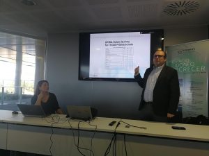
Last December 1st, GEOTEC hosted an industry talk addressed to our Erasmus Mundus students and GEO-C ESRs, by renowned experts from the GIS sector: Jesus de Diego and Jelena Stosic. These are some brief notes from the talk.
The day opened with Jelena who, as senior consultant connecting university-company, introduced the vision and aims of the company. IDOM is an international consultancy firm in the field of engineering, architecture and consulting. IDOM provides integrated services across multiple business areas and sectors such as utilities and energy, transport, environment, and e-government across the world (44 offices in 25 countries!). In Spain, IDOM has offices in Bilbao, Madrid, Valencia and Seville.
Jesus covered professional opportunities in the GIS sector and examined desired skills and competences for GIS professionals, remarking that increasingly GIS and IT is a tight couple and will be even reinforced in the coming years. Deeping into career development, three GIS profiles were identified: GIS users, GIS experts, and GIS technicians. The latter profile implies having strong IT skills. GIS technician is further divided into specific profiles such as Project manager, GIS consultant, GIS analytics and GIS developer.
Afterwards, Jesus – taking the role of senior GIS consultant and project manager – summarised three successful projects deployed by IDOM (full list at https://10.2.20.222/wrodpress/projects).

- Localiza-Spanish Railway GIS Control Center, deployed in the main monitoring screen at the Renfe control center in Atocha. See video presented at the 2017 ESRU Spain user conference in Spain
- Notably, the Smart Transport Information System Abu Dhabi was the most remarkable example. DARB is an interactive map-based web application that provides mobility-related functions such as multi-modal journey planner, carpooling and user-generated reports of new traffic incidents. It is a good example of a running GIS project for Big Data.
- Human Granada Smart City contains a set of tools, in which a web-based routing planer accounting for the slope criteria to meet the needs of distinct types of users (pedestrians, kids, impaired people, trolleys).
At the end of his talk, Jesus offered possible topics for EM students’ master project thesis, which definitively represent new research avenues for the spatial research community.
- Big data: GPS; cellular phones (phone service providers)
- Indoor locatization
- Connected vehicles
- Blockchain & cadastre
- Internet of things
I hope the talk will be a definitive take-off for building up a prolonged and strong academia-industry relationship, and to connect GEOTEC research members to stakeholders, as interested actors in industry or government.
We are looking forward to collaborate with IDOM!
- Posted by geoadmin
- On 2 December, 2017
- 0 Comments


0 Comments