UN official Laura Díaz presents topics of interest to @MASTERGEOTECH students
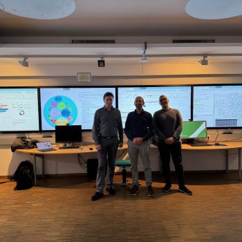
As part of the series of industry talks in GEOTEC (Salva in February 2023 and Laura in February 2024), the Chief of the UN Data Management Unit, Dra. Laura Díaz gave an industry talk on December 2nd, 2024 to the students of the 2024-2025 edition of the Erasmus Mundus Master in Geospatial Technologies.
Similar to her February 2024 presentation, Laura introduced the UNGSC in Valencia, the first UN permanent logistics base to meet the needs of UN peace operations worldwide. She overviewed the UN base organisation and partners, which are many as one may expect. After this brief contextual introduction to UN, she continued by presenting the Client Solutions Delivery Section (CSDS) as the supplying provider of geospatial, information and innovative technologies to UN field missions.


Central to the UN CSDS is the UN Maps service, an in-house mapping creation and delivery service. Laura emphasised it has specific challenges since each field mission requires particular mapping needs. UN Maps combines street maps, image maps, directions, operational maps (e.g. for UN activities, operations and locations in the area) used for example for patrolling, planning and reporting in a field mission. Indeed, UN Maps strongly leverages crowdsourcing, among other data sources and technologies, to create local maps as much accurate as possible.
Complementing UN Maps, another UN CSDS’s line of work is data management in general, but especially from the perspective of the IoT Data Pipelines concept. IoT data and sensors work in play with the Unite FRIM (Field Remote Infrastructure Monitoring) to continuously monitor sensors deployed in mission camps. During the first semester of the 2024-2025 academic course, some third semester students are doing their master thesis on topics related to IoT data monitoring and data quality assessment in real UN mission camps in Africa. Another key product is the Unite Aware, the UN’s situational awareness platform for operational, data-driven decision making in UN field missions.
Next, Laura stepped into the UN’s vision and strategy for data management, delivery and sharing. Here, topics of interest are data readiness, quality, accessibility and interoperability. Well these topics are old friends to the SDI community, but still are interesting offers to students for their master’s theses, specially if these topics are coupled with recent technology developments and real scenarios. One of these recent technology actors in GeoAI, i.e. the fusion of IA and GIS capabilities, such as object detection in satellite images using different techniques, groundwater services (classification, analysis, estimation of the best places to drill wells, etc.), flood impact analysis, analysis noise impact, and air pollution analysis. Within the UN vision of data pipeline, AI for data quality control was also identified as a potential topic. Data quality is not a very popular topic, but it is extremely necessary to realize the vision of the data pipeline. In this sense, things like identifying data quality criteria without human intervention or automatically suggesting corrective actions to create data of sufficient quality are priorities for the UN, especially since having data of good quality and form is essential to maintain peace in field missions.

To close her talk, Laura showed some ideas in such as Digital Twin as a service and Immersive Augmented Reality (XR) solutions, accompanied with a real use case for monitoring convoys using satellite imagery that combines some fo the UN tools and services commented during the talk. Thank you Laura (and Lara Prades too) for giving again a great industry talk to our Master students and GEOTEC members.
- Posted by geoadmin
- On 2 December, 2024
- 0 Comments


0 Comments